Martinborough

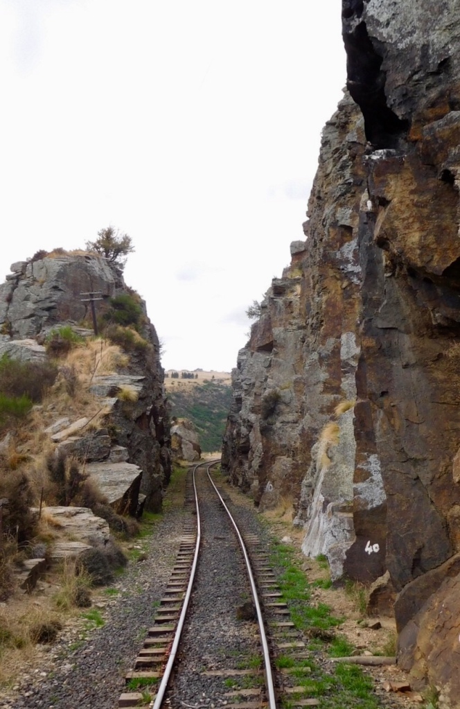
We enjoyed a pleasant crossing of the Cook Strait to return to the North Island. We dove east through the Rimutaka Forest Park, a mountain range with twisting switchback roads full of mid-day traffic. The area is meteorologically isolated, creating a pleasant climate in the Martinborough area but a challenging drive to reach the area.

The small town of Martinborough is known as a weekend destination for wine-tasting excursions. The shaded central square with its old hotel, boutique shops and wine bank provides a quaint setting for a town devoted to wine tourism. A number of small vineyards are within walking distance of the town square and can be easily visited in an afternoon.

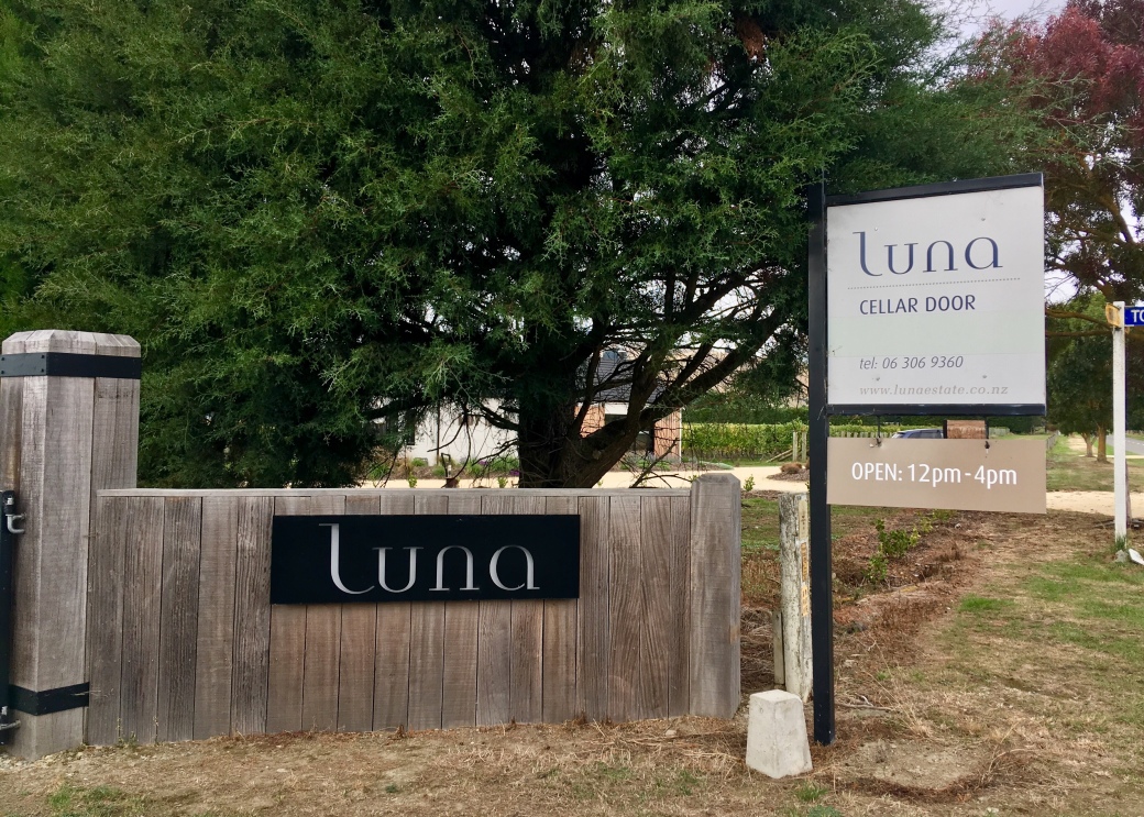
Ata Rangi Vineyard was recommended to us, and we enjoyed an interesting private tour and tasting. A visit to Luna Vineyards was next to sample wines that are exported to China.

Olive trees grow along the roads.

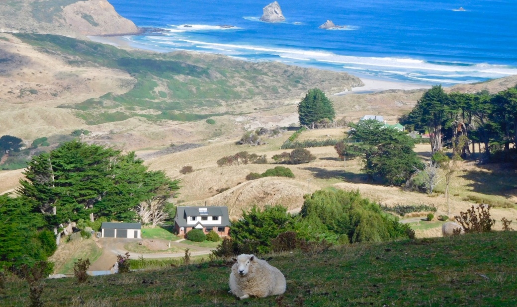
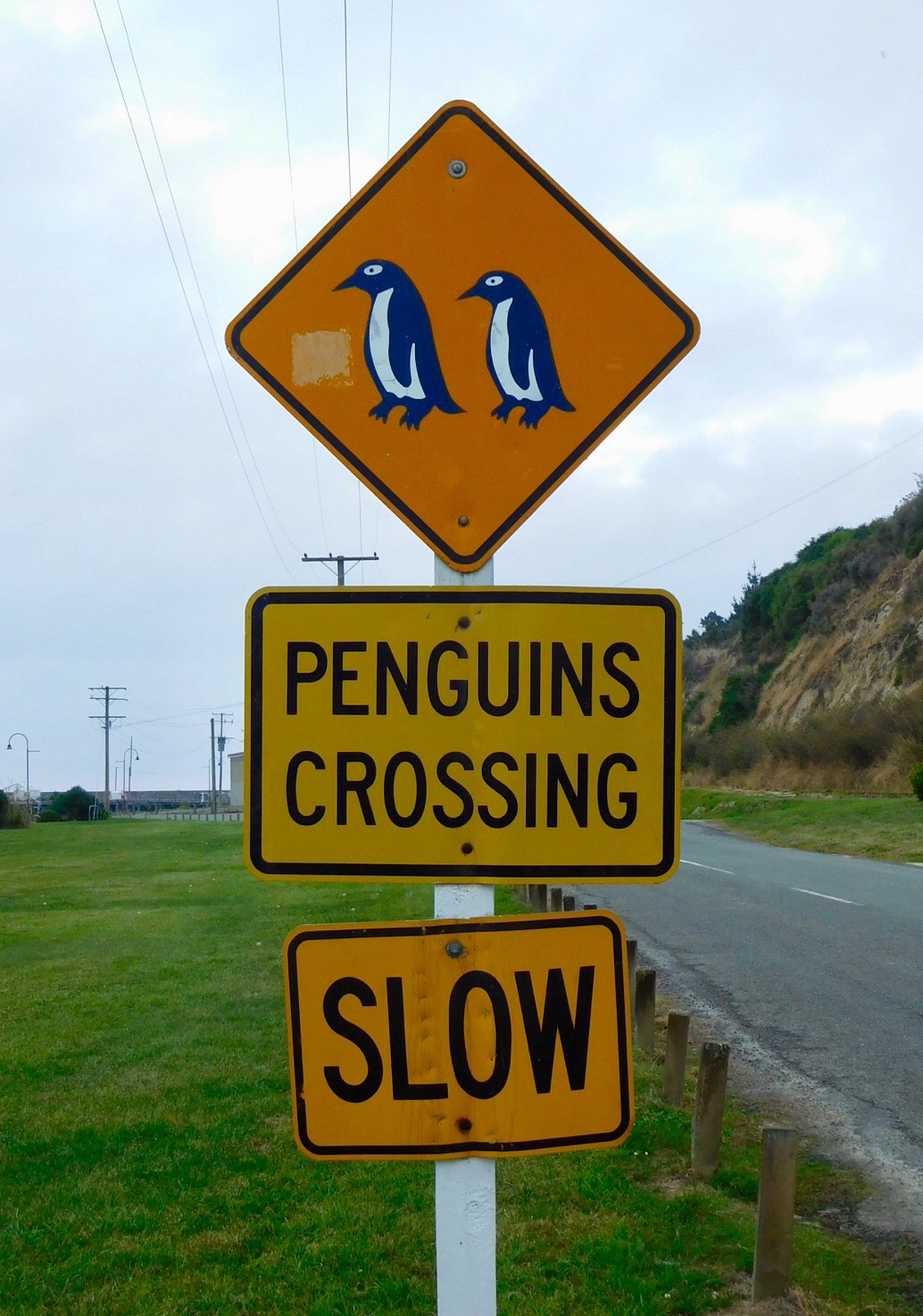
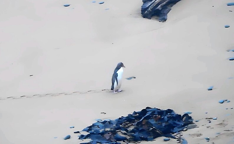
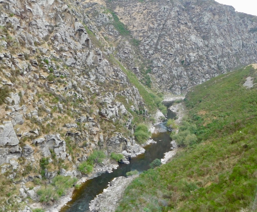
An hour’s drive south of Martinborough is the resort town of Lake Ferry and the Cook Strait. This coast is rough surf, huge waves breaking on a stony beach. We spotted a lone fur seal basking in the weak sunshine. The landscape is dramatic cliffs made of layers of clay and rock from long-gone river beds and steep-sided valleys and lowland pastures, dotted with sheep.

A fur seal

Before we left Martinborough, we enjoyed a special treat, a delicious 3-course dinner at Tirohana winery. Even better, van service is provided so we were free to enjoy the cellar’s wonderful vintages.

Blenheim and Martinborough

April 1

The plains of the Wairau Valley is the most prolific wine-producing region in New Zealand. We enjoyed magnificent views of the Marlborough hills and the Awatere River as we toured some vineyards in the region.

Yeamans Winery is on the Awareke River, overlooking Cook Strait.

Moa Brewery / Cidery has a sculpture of the extinct bird in its courtyard.

Crossing the Cook Strait, we head to Martinborough, another wine-producing town on the North Island. From our cottage, we could walk to half a dozen wineries within a couple of kilometres. The most memorable tour and tasting was hosted at Ata Rangi vineyard.

Olive groves as well as vineyards in Martinborough

Tirohana Vineyard offers a fixed-price 3-course meal in a beautiful setting. Transportation is provided to and from accommodations in Martinborough. 

Beautiful landscapes south of Martinborough through more pastures and farms to the coast overlooking the Cook Strait. A rocky beach near Lake Ferry is a resting place for fur seals.

Kaikoura

March 30

Once a booming fishing town, Kaikoura now relies on tourism based on the marine life. Humpback whales, dusky dolphins and fur seals can be viewed from boats and sometimes from the shore. Crayfish are still a viable harvest; the town hall was designed to resemble a crayfish trap.

Seal on the boardwalk

Seals on the rocks and in the water near the boat where snorkelers are hoping to swim with them.

Evidence of the damage caused by the 2016 earthquake is described in detail in the local museum. Occurring at midnight, it sent shock waves northwards towards the North Island and out to the Pacific

The coastline was lifted up to 9 metres in some areas. State highway #1 and the rail line along much of the coast were destroyed by rockslides, cutting off the town. Provisions usually shipped by rail were no longer available. Travel connections to the rest of NZ now depended on boat and helicopter. Townsfolk and travellers had to be fed and housed. Tourists were stranded and were slowly evacuated by air or sea. The town become a parking lot for rental vehicles as RVs and cars were abandoned with keys in ignitions, until the road was restored and companies could claim their vehicles. Stories of the stress, uncertainty, hardship and ingenuity are recounted in first person interviews in video clips.

Even now, a couple of years later, reconstruction continues with crews working to stabilize the cliffs over the road and the shore line below. Rail service was reinstated in November between Christchurch and Picton.

Walking path at the base of the cliffs at sea level and along the top of the headland

Town clock with Maori panel honouring the town’s heritage

A shopping area created with shipping containers is still in use.

Whale bones along a walking path recall past connections with the sea.

Monarch caterpillars

Quilt depicting the earthquake; bottom rows shows the marine life exposed by the upheaval and left to rot in the weeks that followed. The stench was overwhelming.

Christchurch to Greymouth via TranzAlpine

March 28

We enjoyed a spectacular coast-to-coast train journey from Christchurch across the Canterbury Plains through Arthur’s Pass and the mountains to Greymouth. A stop in Arthur’s Pass provides access to trailheads for those hiking in the national park. This is the highest of the passes through the Southern Alps. A half-hour stop is scheduled in Greymouth, then the train returns to Christchurch the same day.

Apart from the geography, there is a difference from west to east due to the difference in rainfall. Some locations in the mountains measure rainfall in metres per year while the plains receives less than a metre. Dry conditions in the east provide pastures for sheep. Winter temperatures frequently drop below freezing. In the west, lush rainforests cover the lower slopes of the coastal mountains and temperatures are moderate year-round. In the mountains, heavy rains and snow-capped peaks are the norm.

River beds are composed of rock carried down from the mountains. Waitamata River cuts through a gorge on its way to the Tasman Sea. There are 16 tunnels and 4 viaducts along this rail line; Otira Tunnel is the longest at 8.5 km and was considered an engineering feat when constructed in 1923. Staircase Viaduct is the highest at 75 metres.

Arthur’s Pass has the highest elevation of the passes that cross the mountains.

Moana is the village at the centre of cottage country on Lake Brunner near Greymouth.

The clouds lifted for the return journey.

Antarctic Centre

March 27

One of the must-do attractions in Christchurch is the International Antarctic Centre featuring informative displays about the history and present status of international exploration and research there. As well as the serious side, penguins (rescued birds), a special cold room to emulate blizzard conditions (parkas, boots and mitts are provided), and the opportunity to ride a Haggland (snow-cat) are available. Across the road, the US has a large facility; many countries are participating in Antarctic research and Christchurch is an important gateway to the South Pole.

Little blue penguins reside here; these are injured birds who can’t be rehabilitated back to the wild, just like the birds we’d seen in Napier. Dogs are a nuisance to penguins, kiwis and other flightless birds. As a result, NZ’s Department of Conservation have banned dogs from national parks.

A pose from the movie Madagascar?

Little blues are awkward when walking on land, agile swimmers at feeding time

Christchurch

March 26

Our stay in Christchurch started with an early morning walking tour to hear how settlers who came from England in 1850 recreated their version of the British class society here. Tradespeople, artisans and labourers travelled along with the landed gentry, their sponsors. The centre of the city is a lovely green space with mature trees and graceful bridges over the Avon River. The statue of Captain Cook is undergoing reinforcement to prevent further damage from earthquakes.

While many of the heritage buildings were damaged in the earthquakes of 2010 and 2011 and subsequently destroyed, the city still retains some of its British origins in the traditional neo-Gothic architecture of Christ’s College, a boys’ school, and the University of Canterbury.

Our walking tour covered the areas most severely affected by the earthquakes. Some buildings have been demolished, others have been condemned and fenced off. Vacant lots are scattered down city blocks and are used for parking, green spaces, art installations and shops and services in shipping containers. The Anglican cathedral was severely damaged; its future is in limbo as it has been the subject of legal action.

Just like the statue of Captain Cook, these figures have been strapped in place until further repairs.

With the destruction of the Anglican cathedral, a new building was commissioned. The Transitional Cathedral was designed by a Japanese architect and constructed 2 1/2 years after the quakes. It’s referred to as the ‘cardboard cathedral’ because of the sonotubes used in its roof design. The offices and kitchen along the sides of the structure are repurposed shipping containers. These were a common sight in the weeks and months immediately following the quakes and were used as shopping malls, temporary offices and storage. Some are still in use as cafes, tourist offices and souvenir shops.

Some final scenes of the city, including the memorial site for the victims of the March 15 terrorist attack.

A monument to Kate Sheppard and the suffragettes who secured the vote for New Zealand women in 1893, the first country in the world to grant universal suffrage.

Back to the Pacific Coast at Akaroa

March 24

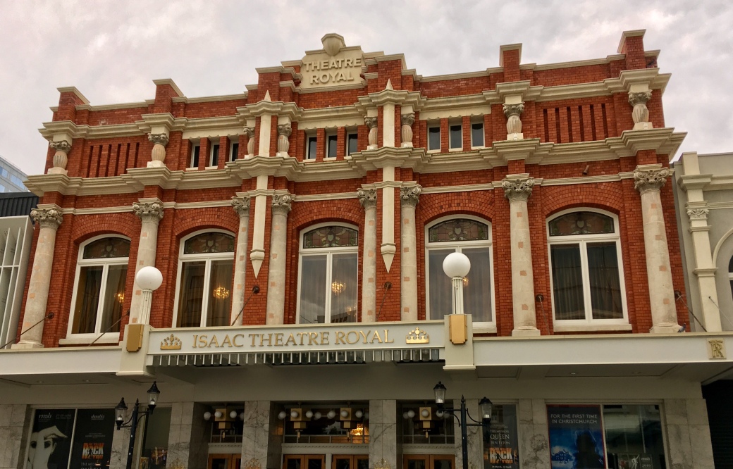
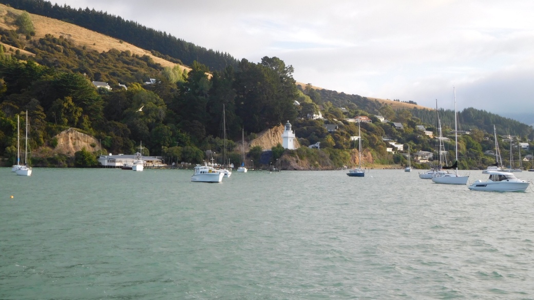
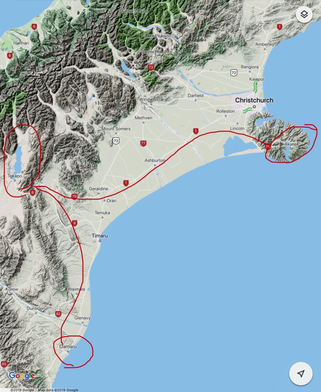
From Lake Tekapo to the seaside village of Akaroa is a full day’s drive when a stop for coffee and cake in Geraldine and a grocery run in Asherton is included in the trip.

Akaroa, on the mountainous Banks Peninsula, was originally founded by a French whaling captain. In 1840 he returned from France with 60 settlers and discovered the British had arrived in his absence. The early French influence remains alive with street names, flags and a sense of French culture.

The QE2 arrived early one morning during our stay to turn hundreds of passengers loose on the narrow streets. Most would take bus tours into Christchurch, about an hour’s drive away.

We took an early morning boat tour of the harbour to see petrels, albatross, shags, penguins, terns, gulls and fur seals as well as the interesting rock formations.

Shags on the rocky shoreline

Fur seals basking in the sun

The old lighthouse overlooking the inner harbour

We toured the Giant’s Garden, a private mosaic sculpture garden that reminded us of Parc Guell in Barcelona.

En route to Christchurch, we drove through the port town of Lyttleton along lovely coves and inlets. Lyttleton’s harbour suffered extensive damage when the sea floor rose during the Christchurch earthquakes. As a result, cruise ships use Akaroa for access to Christchurch.

Northwest to Lake Tekapo

March 21

Heading inland again, we travelled through pastures, along rivers and around lakes with hydro-electric power plants to Lake Pukaki for our first stop of the day. The visitor centre at the bottom of the lake provides wonderful opportunities to photograph Aoraki Mount Cook, the tallest mountain in New Zealand – on a clear day. We were fortunate to see the summit through the hazy clouds.

On to Lake Tekapo for more beautiful views of the Southern Alps beyond the lake. We hiked Cowans Hill through pastures and forests back to the village of Tekapo. A soak in the hot pools at Tekapo Springs eased weary legs and feet.

The Church of the Good Shepherd is a popular photo subject on Instagram. We tried to capture it on a cloudy night with the full moon rising and during the day with busloads of tourists tours all trying to do the same thing.

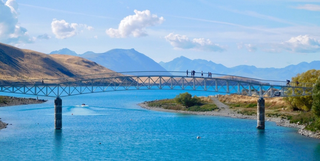
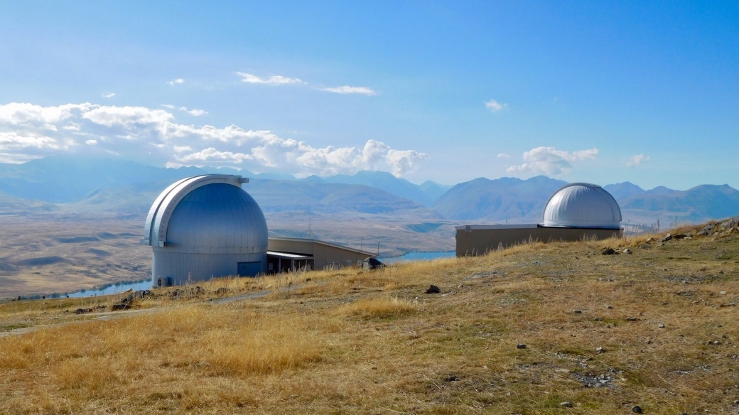
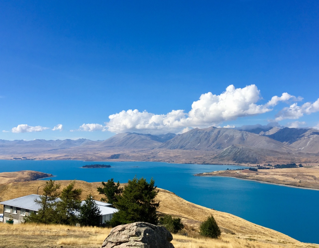
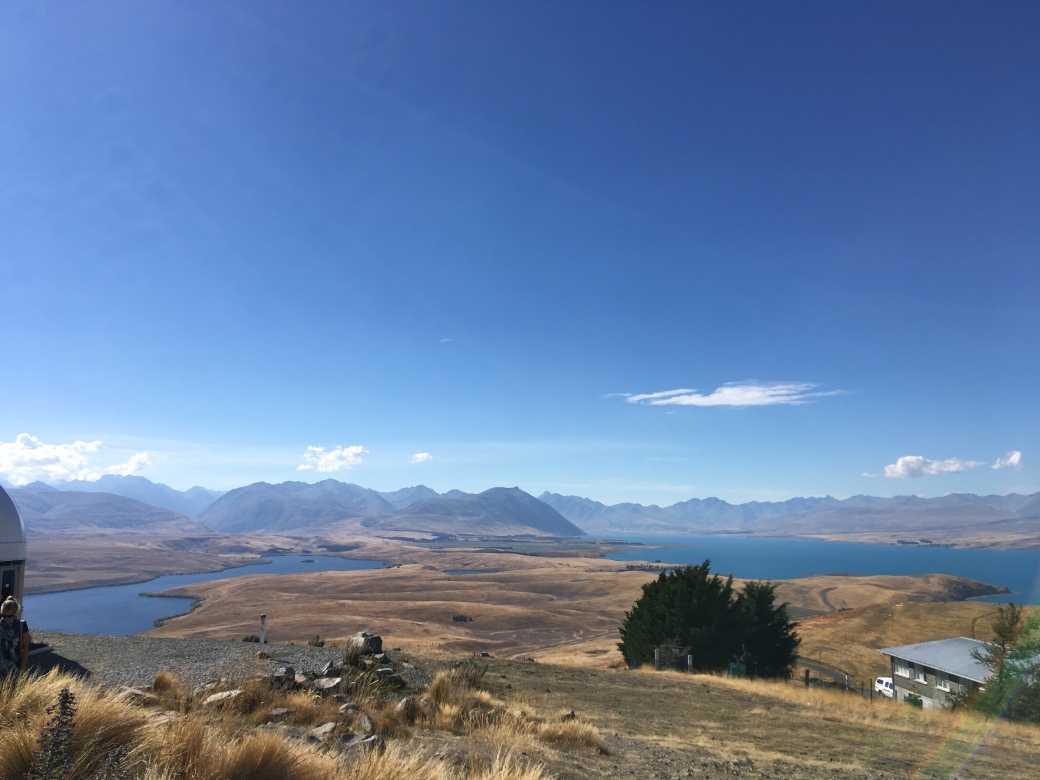
The observatories at Mt. John are staffed by faculty and students of the University of Canterbury, Christchurch. This area is a dark sky reserve, making it ideal for astronomers. Star-gazing tours are offered at a couple of observatories in the area. The views during the day take in Lake Tekapo, the Mackenzie Plains and the Southern Alps.

The Otago Peninsula and Oamaru’s Penguins

March 19

Steep hills dotted with sheep, tiny bays and inlets, wild sandy beaches and winding coastal and high roads are features of the Otago Peninsula, a recreational area for the city of Dunedin. Tours to view the albatross nesting site and penguin colonies are popular tourist attractions.

Looking across the harbour to Dunedin

Allan’s Beach on the Pacific coast of the peninsula

An albatross uses its 3-metre wingspan to glide effortlessly on the wind.

On the drive from Dunedin to Oamaru, we stopped to see the Moeraki boulders, a geological curiosity. These are almost perfect spheres of gray rocks, about 3 metres across, scattered along the beach, half-buried or emerging from the cliffs.

Further north, Oamaru’s little blue penguin colony is the must-see attraction in town. The penguins are protected and studied to learn more about their current status and survival. We waited patiently in the viewing area with many others until, after 9 pm, the penguins clambered up the rocks heading for their burrows after a full day at sea. They are small birds, weighing a kilo or less. This photo was taken at a rescue facility in Christchurch as photography was not permitted as the birds came ashore.

We learned that farther down the shore at Bushy Beach, a small colony of rare yellow-eyed penguins have been seen. Fortunately, a monitor was on site to provide some info about the birds and how to see them. Access to the beach is restricted after 3 pm; we watched from trails and viewing platforms high above the beach.

Steampunk HQ is a quirky museum displaying Victorian sci-fi creations.

Dunedin and the Taieri Gorge Railway

March 18

Dunedin Railway Station is a treasure of a building with its gingerbread exterior, Royal Doulton mosaic floor tiles and wall ornamentation. When it opened in 1906, it was the largest and busiest station in New Zealand, the hub of the commercial centre.

Taieri River is the third longest river in NZ. The Wingatui viaduct and twelve tunnels are required for the train to travel from Dunedin to Pukerangi. When originally constructed, the train delivered miners to Central Otago and moved produce and livestock on the return journey to Dunedin and north.

Scenes of Dunedin:

A needlepoint panel depicting the settlement of Otago hangs in First Church, the most impressive 19th-century churching New Zealand. Depicted from left to right are the two Presbyterian churches in Scotland where the founding minister served, the ships bringing the settlers to Otago, and First Church with the town and countryside in the background.

Signal Hill overlooks the city and the Otago Peninsula. Even though the weather is misty, the spire of First Church is easy to spot on the right, the railway station with its red roof in the lower left.

Cadbury has a presence in Dunedin.

Across from the railway station is the building housing the Dunedin Law Courts.

The Otago Museum is one of the best I’ve visited. Wonderful displays on natural history, Maori and Pacific cultures, and eclectic collections, among others, are beautifully presented. We spend some time in the tropical rainforest butterfly house with species native to the Philippines and the South Pacific.